Home Maps Historical Aerial Recollections The Road CARA
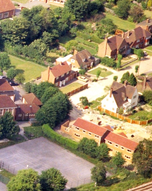
The following five photographs were kindly made available to CARA by the Ashcombe School. They were taken between 1973 and 2007, the earlier ones from an aircraft and the those in 2007 by a drone. They were obviously from a series to show the layout of the school, but Croft Avenue figured quite strongly in several photographs so these have been cropped to concentrate on the Avenue.
These photos can be downloaded and cropped to produce a unique aerial photo of your house in four easy steps:
Photo A:
Taken in 1973 from an aircraft. This shows the top end of Croft Avenue with houses 16, 18, 20, 22 & 24 on the left; 27 and part of 25 on the right; and the unfinished 26 & 28 in the foreground.
Photo B:
Taken in 2004, possibly by a drone. Showing the road running from left to right, with the railway at the top of the picture and the A24 on the left.
Photo C:
Taken in 2007 from a drone. This the same angle as Photo B.
Photo D:
Taken in 2007 from a drone. This shows Croft Avenue running from bottom to top of the photo. The A24 (with the school buses in the lay-by, blocking our view as we try to join the main road!). Railway on the left of the picture.
Photo E:
Taken in 2007 from a drone. This shows Croft Avenue running from bottom left of the picture to top right. Fairfield Drive and the railway on the left.